
My last update: February 21, 2014 @ 7:50 pm.
Day 1
Day 2
Day 3
Day 4
Day 5
The Video
SAULT STE MARIE, MI — Bertha Benz, the wife of Karl Benz, was the first person to take a road trip. Without telling her husband (or the authorities), she took a Patent Motorwagen and drove with her children Eugen and Richard (fifteen and thirteen years old respectively) 66 miles, from Mannheim to Pforzheim. She left at dawn on August 5, 1888 and arrived at her mother’s home at dusk. They returned the next day.
Along the way, she had to stop at an apothecary for ligroin as fuel, had a chain fixed by a black smith, and invented the brake lining. She may have also created the first iPhone on the same trip so she could call her husband, the inventor of the automobile, to say, “Who’s the boss?”, but that’s probably apocryphal.

Mrs. Benz’s ride

My ride, over 125 years later
With Bertha’s spirit to guide me, I’ve decided to drive down the entire length of I-75 (give or take). Hopefully my trip will be substantially easier than hers. Subaru didn’t equip my car with heated seats or mirrors for its model year, so it’s about as primitive as Mrs. Benz’s car, but I think I’ll manage.
 I-75 starts at Sault Ste. Marie, Michigan (Sault is pronounced “soo” in Michiganese). This is the home of the Soo Locks (pronounced “Sault”), which joins Lake Superior with Lake Huron. I could have started in Canada, but I find their friendliness suspicious.
I-75 ends somewhere near Miami[1], but I’m going to continue on to Key West because, well, that’s where the road ends.
According to the infallible Google, that’s 1,940 miles and 29 hours of driving.
“I haven’t been everywhere, but it’s on my list.”
—Susan Sontag
Contemplation
I could list a half dozen reasons why I shouldn’t do this, from the weather, to my work load, to how much I hate Michigan’s upper peninsula in winter, but then again, I have new winter tires. What could possibly go wrong?
A lot, actually, if my recent problems with cars is any indication. I’ve had self-inflicted tire problems and road-inflicted ones. I’m missing car body parts from encounters with snow walls. And that’s when the optimistic engineer in me decides that the law of averages is in my favor right now. Not that it matters. I’m going.
“Would you tell me, please, which way I ought to go from here?”
“That depends a good deal on where you want to get to.”
“I don’t much care where –”
“Then it doesn’t matter which way you go.”
—Lewis Carroll, Alice in Wonderland
DAY 1
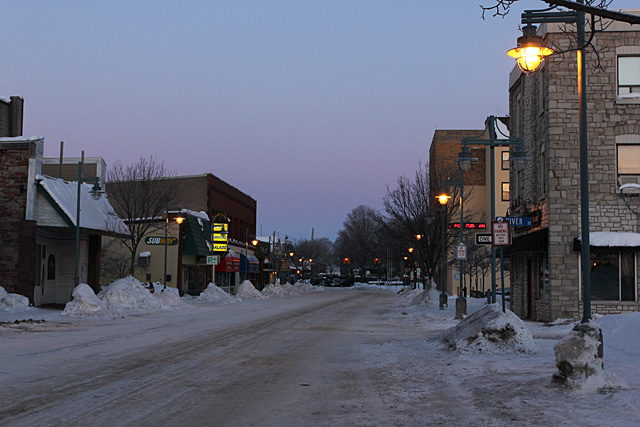
Monday, February 17, 2014, 7:50 am EST: 0 miles / -3°F
HOTEL OJIBWAY — In the land of my birth, today’s weather forecast is 88°F and sunny, with a chance of volcano. Here, it’s -3°F outside. At least it’s not snowing. I’m wearing long underwear. I have woolen socks and thermo-nuclear powered polar mittens on. Or I will, once I finish typing this from the parking lot (the hotel has a surprisingly strong wifi connection). Driving to Detroit would actually improve weather conditions.
Sault Ste Marie is at the same latitude as St. Moritz, Switzerland. At least it has that going for it. The snow here is very noisy. It squeaks whenever you step or drive over it. The gas pump was very slow when I tanked up this morning. I’m sure it’s not related to the cold, but all I could picture was gasoline jelly oozing into my gas tank.
If I went to school anywhere in the Upper Peninsula, I would have certainly taken up either drinking or studying.
I’m very happy to leave this place. Next stop, anywhere else.
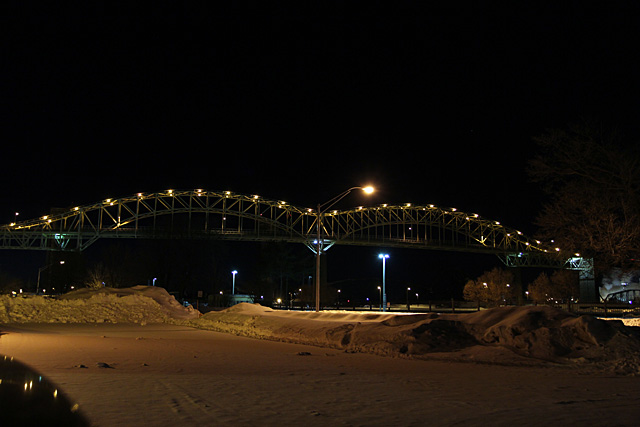
Monday, February 17, 2014, 10:10 am EST: 112 miles / +9°F
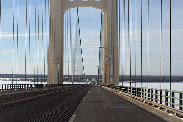
The Mackinac Bridge (pronounced “Mackinaw”) connects St. Ignace in the Upper Peninsula to Mackinaw City (pronounced “Mackinac”) in the lower peninsula. (In Michigan, there’s actually no such thing as “lower peninsula.” We’re just the trolls that live under the Bridge.)
Everytime I drive over the Mackinac Bridge, I think about the Yugo that went over the edge back in 1989, and I change from the outside lane to the center lane. Then I remember that the car was blown over from the winds that came from under the bridge through the grating in the center lanes, and I switch back to the edge lanes.

The extra layer of clothing came in handy for this shot
Because of the shape of the lower peninsula, we refer to parts of that state anatomically. For example, Port Huron is in the “thumb” area. Is there a name for this area where I am right now, near Gaylord and Grayling? Do we call it the Middle Finger Upper Knuckle area? Would Traverse City be in the Pinkies? There should be a referendum on this.
Monday, February 17, 2014, 1:50 pm EST: 322 miles / +21°F
AUBURN HILLS, MI — Less blogging, more driving.
A Few Thoughts About Michigan
There must be more snowmobiles in the Upper Peninsula than automobiles.
Because so much of the Great Lakes are frozen, there’s not as much lake effect snow. Yay, Polar Vortex!
I-75 is in surprisingly good shape, except in the places where I drive it regularly.
Everybody knows the song about a city boy, born and raised in south Detroit, but that doesn’t actually exist. It’s Downriver, which is everything below the Ambassador Bridge that doesn’t include Canada. There’s never anything bad in Canada.

45th parallel… hmmm…. this gives me an idea…

Bullseye

“South Detroit” Marathon refineries
Monday, February 17, 2014, 3:27 pm EST: 406 miles / +24°F
OHIO — Picture yourself at a picnic on a warm summer day. You wake up and find yourself dipped in honey and covered with mutant crazy ant / tawny fire ant / Ohio police hybrid that’s eating you alive until you wake up and realize that it’s actually true—you really are in Ohio.
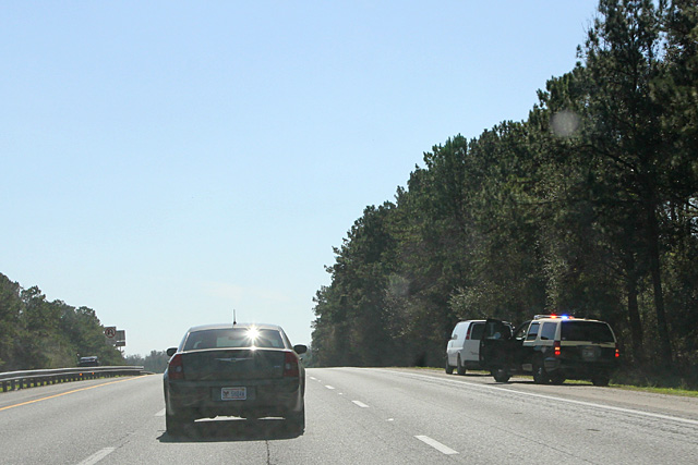
Or maybe that’s just me because I tend to speed. I don’t speed all the time, of course. Only when I drive. And I have a deep-seated fear of speeding tickets. There is obviously no possible way to solve this problem.
Unfortunately real reality doesn’t seem to agree with my reality. I saw way more police pulling people over in Michigan than in Ohio on this trip. It doesn’t matter—I’m sticking with my irrational fears.
It doesn’t help that the first city you enter in Ohio on I-75 is Toledo. Michigan and Ohio once fought over Toledo, and fortunately we lost.
Monday, February 17, 2014, 3:27 pm EST: 527 miles / +28°F
SIDNEY, OH — So the ice storm happened. I tried with all my might, but somehow reason still prevailed and I pulled off the freeway to stop for the night. I hate Ohio.

This was the easy stuff. The freezing rain came later.
DAY 2
Tuesday, February 18, 2014, 8:30 am EST: 527 miles / +30°F
SIDNEY, OH — As I load up my car, I have to wonder if I am bringing more technology on this trip than the Apollo 11 did in its trip to the moon. I have multiples of some things, like laptops and cell phones. I have regular cameras and video cameras. I have wifi hotspots and GPS loggers. I even had a navigation system that tells me where businesses used to be.
What I don’t have is a rocket with 7.6 million pound-force of thrust. I’m only ¼ of the way to Key West, so I’ll be doing more driving and less blogging today to make up time. I’m dawdling right now. There, I dawdled again. D’oh!
And I still have to make it out of Ohio. Pray for me.
Tuesday, February 18, 2014, 9:20 am EST: 545 miles / +28°F
Got my first fill up of the day. That’s always a good start.
I started a playlist back in Sault Ste Marie. After 545 miles and 129 songs, I’ve made it through 2.1% so far. Maybe I need to listen to shorter songs.
Tuesday, February 18, 2014, 10:38 am EST: 620 miles / +42°F
CINCINNATI, OH — Parts of I-75 in Cincinnati are under construction, but it’s always been narrow here as you go up and down and round through town. You feel like you’re in a tight and narrow orifice at the bottom of the state before it dumps you out onto the bridge to Kentucky. Poor Kentucky.
At least I get good gas mileage in Ohio.

This is the bridge to get out of Ohio.
Tuesday, February 18, 2014, 11:33 am EST: 690 miles / +51°F
I like rolling through Kentucky on I-75. It’s mostly 3 lanes and the road is in good condition with minimal traffic.
The only other salt-stained cars I’ve seen so far are from Ontario, Canada. I’m surprised their drivers have not melted into a gooey pool on the floor mat as it’s a balmy +51°F around here.
Actually, the temperature has me a bit worried since it’s above the magical +45°F for winter tires. I’d dive for snow on the road, but there isn’t any. This is about where I’m seeing more dirt than snow around.
Tuesday, February 18, 2014, 1:32 pm EST: 840 miles / +64°F
CARYVILLE, TN — The lady at the gas station tells me that +64°F is above normal for them. My body feels weird walking around outside without a winter coat, gloves and ushanka on. I feel like finding a warm rock somewhere and warming my belly in the sun. Sorry, TMI.
(As someone who wears a winter coat into May, I’m still dressed more warmly than anyone else here.)
I started this trip consuming grapes, bananas, and tea. I’ve devolved to Twix, chips, and Mountain Dew. The only movements I’m making are moving my eyeballs to scan the road and my thumb to change the volume. Go, Diet!
As I leave the gas station, I notice that it has a weird exit/entrance to I-75. You have to cross a main road to get between the gas station and the freeway. The exit and entrance ramps are both about 50 yards long. That’s when I realized I’ve been here before. Not quite déja vu, but odd.
Tuesday, February 18, 2014, 11:35 pm EST: 1311 miles / +64°F
PEACHES, GEORGIA — Okay, Peaches isn’t a real place, but it should be. I have the urge to listen to country music, but I haven’t broken 300 songs on my playlist yet.
As I look around at all the billboards and buildings here, I wondered about how people travelled back in the day. Not just in Mrs. Benz’s times, but even further back when people used Conestoga wagons. They had to deal with issues like not having roads, gas stations, or restaurants. They had to climb mountains, ford rivers, and cross deserts using only 1 or 2 horsepower. They trespassed on land where the homeowners shot at them with bows and arrows. Coyotes would drop anvils on them and dingoes would drag their children away. And they did this all without Pandora or iTunes.
What are our greatest dangers in driving today? Other drivers, weather, and boredom.
Instead of watching out for dangerous animals, we play road bingo. Our kids’ library of cartoon DVDs (or Blu-ray) isn’t enough, they need their video games, too. We have cup holders that keep our drinks at appropriate temperatures. Our seats massage us. They can keep us warm in winter or cool in summer. We don’t need Billy Joe Bob with his banjo at the back of the wagon to entertain us, we can have music beamed directly to us from outer space.
I’m sure Mrs. Benz would have been happy just to be able to sit inside the car, let alone having automatic climate control.
I’ve had my share of hardships on this trip. I’m suffering with a wifi hotspot that’s a tad slow as my Google Earth is a bit laggy now and then. My navigation system likes to find the ghosts of things past. I’m down to my last Twix bar. And I went through Atlanta during the afternoon rush hour. I would rather have an anvil dropped on my head than go through that again. So glad I have a manual transmission and not that namby-pamby dual-clutch thing.

Make it stop!! Oh, wait—we are.
The traffic jams we saw of Atlanta a couple of weeks ago weren’t from the snow, that was probably just normal rush hour.
DAY 3
Wednesday, February 19, 2014, 10:31 am EST: 1315 miles / +64°F
VALDOSTA, GA — I’m just 15 minutes from the Florida border, and it’s green here. Not summer-like, more Michigan May-like. I’m finally heading into the last state of my trip.
What’s the big deal about Florida? Sure, in the Sunshine State, the temperature is warm, there’s no sales tax, and young people are frolicking on the beaches. But I think Michigan is the better state.
Top 11 Reasons Why Michigan is Better than Florida
- It’s easier to drive to Canada than swim to Cuba during the zombie apocalypse.
- The abbreviation MI is one of the beautiful notes Julie Andrews sings. FL is the abbreviation for fluorine.
- Florida sports teams have won too many championships requiring lots of cleaning up after parades.
- Michigan has no law specifically outlawing blue-colored brake fluid (ATE Super Blue).
- Florida’s most famous citizen is a giant mouse. That’s what we feed our pet Burmese pythons before releasing them into the wild.
- Detroit—biggest municipal bankruptcy in U.S. history. (Detroit is #1!)
Florida is hot and muggy in summer.- Michigan homeowners find bugs and leaves when we clean our pools. Florida homeowners find crocodiles.
- What Florida calls “hills” we call “frost heaves.”
- Florida will sink into the ocean once all of the snow from Michigan melts.
- Michigan’s two peninsulas > Florida’s one
Wednesday, February 19, 2014, 3:01 pm EST: 1585 miles / +82°F
CREEKWOOD CROSSING — I’m sitting in the shade working on my laptop while a warm breeze refreshes everything. That makes this feel more like a vacation than the delusional obsessions of an irrational enthusiast. I may stay here a few minutes longer than planned.
I saw on the Weather Channel this morning that winter storms are forecasted for some areas in the north and midwest. To show that I’m thinking of you, I will only turn on my air conditioner when the sun is shining.
I heard the Allman Brother’s song “Jessica” on my playlist and I pretended I was on a Top Gear episode (though hopefully not the one in Alabama).
Wednesday, February 19, 2014, 7:32 pm EST: 1802 miles / +76°F
I felt a bit of euphoria when I saw the sign. It said: I-75 Ends, ½ mile. It’s the pot at the end of my rainbow. I couldn’t get a picture of it, though, and there won’t be a next time.
DAY 4
Thursday, February 20, 2014, 7:15 am EST: 1315 miles / +72°F
At any given moment I’m doing one of three things on this trip (listed in order of time spent):
- Driving
- Blogging
- Sleeping
I’m trying my best not combine any two. I do the last one the least and yes, I’m counting sitting in traffic jams as “driving.”
Thursday, February 20, 2014, 1:15 pm EST: 1974 miles / +82°F
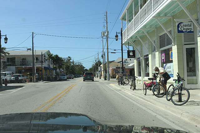
I finally made it to Key West. It’s not horrible.
Leaving the Keys feels like the end of summer vacation.
These changes in latitudes, changes in attitudes
Nothing remains quite the same
Through all of the islands and all of the highlands
If we couldn’t laugh we would all go insane
—Jimmy Buffet
Thursday, February 20, 2014, 3:59 pm EST: 2101 miles / +80°F
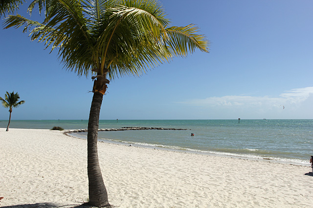
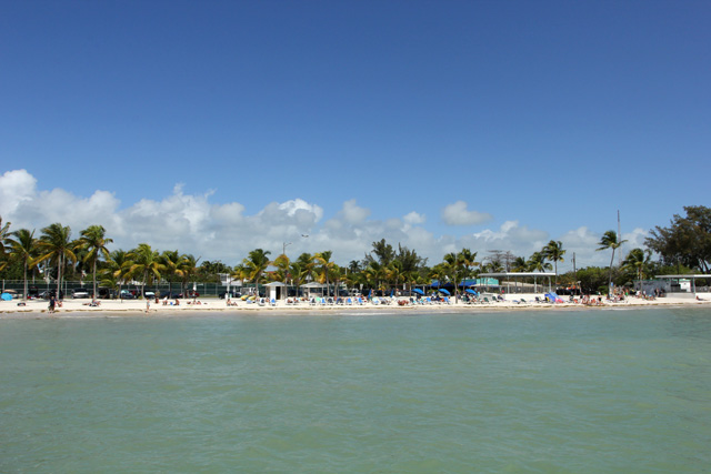
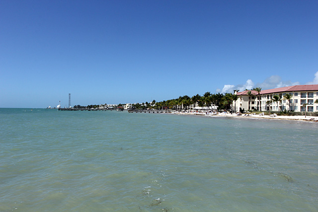
I got to Key West around noon and found a small beach called Higgs Beach. I warmed myself in the sun, enjoyed the refreshing ocean breezes, dipped my toes into the water. After walking around and taking some pictures, I did my favorite road trip task—planning the next driving segments. That was my hour in Key West.
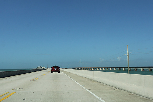
The drive from Florida City to Key West on the Overseas Highway is about 125 miles and takes around 3 hours. I didn’t see any crocodiles, Burmese pythons, or parrots drinking Margaritas, just a lot of cars.
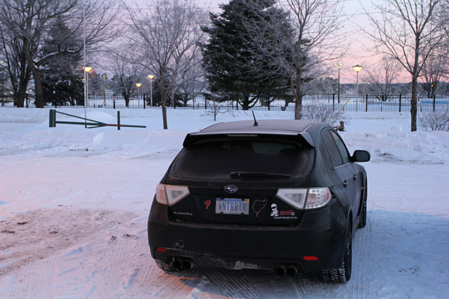
My car was probably the only car in Key West with winter tires on. Or at least, the only salt-stained, all-wheel drive, winter-tired car from Michigan that drove down from Sault Ste Marie. And I’m the only person on the island with two winter coats—my warm one and my warmer one.
One thing I didn’t get a chance to do was clean off the salt from my car while down here. That’s probably okay as I’m sure washing my invasive road salt off would cause an environmental chain reaction that would lead to the extinction of pink flamingoes in Florida. By keeping my car dirty, I’m saving the planet.
DAY 5
Friday, February 21, 2014, 4:30 am EST: 2557 miles / +60°F
GEORGIA — My goal today is to get home. My estimate is 14-15 hours from the Georgia/Florida border to my house. Maybe I can make it home in time for dinner, if I can make it around Atlanta more quickly than last time. I’m checking on-line for anvils, just in case.
Friday, February 21, 2014, 1:08 pm EST: 3132 miles / +50°F
MT. VERNON, KY — It’s still spring-like here in Kentucky, although the wind has picked up. I went through a heavy thunderstorm through Macon, GA. That’s your local forecast on the 8s.
Friday, February 21, 2014, 5:56 pm EST: 3405 miles / +37°F
BLUFFTON, OH — There’s #%$@&*! snow on the ground here, starting at this exit. It’s like winter is coming. The wind is blowing strong and cold.
Friday, February 21, 2014, 7:50 pm EST: 3526 miles / +30°F
HOME, MI — Today’s driving stint of 969 miles today is the second longest I’ve ever done. (My longest is 1,272 miles from Rapid City, SD.) Although I was driving back to the cold north, this was my favorite stint of the whole trip because it was just driving. I didn’t have to worry about pictures or videos or blogging. And I’m home.
When George Mallory was asked why he wanted to climb Mount Everest, he famously replied, “Because it’s there.”[2]
I’m not George Mallory, and Key West is not Mount Everest. And that’s not my reason for going down there.
It’s just my excuse to drive.
Freedom’s just another word for nothin’ left to lose,
and nothin’ ain’t worth nothin’ but it’s free,
—Kris Kristofferson
Summary
The values here are not definitive as they include things like looking for gas stations and hotels as well as Garmin excursions, but they’re my numbers.
1,802 miles – I-75 Start to Finish
1,974 miles – Sault Ste Marie to Key West
3,851 miles – Entire round trip
The I-75 Awards
These are my subjective, non-data driven awards for different I-75 categories. I would have preferred more data in choosing these winners, but my statistics staff of one was very lame this trip. So was my staff photographer and videographer, so not so much photos or videos to back these up. It’s hard to find good help these days. Also, my memory is selective.
(I would love to collect more data on my driving. With advanced analytics all the rage in sports, I could apply it to driving as well. Wouldn’t it be great to know your average speed where ever you go? Or how many feet you need to stop at a given speed? Or how many blinks it takes to change lanes. These are important data.)
Best/Worst Road Surfaces
The non-frost heaved or potholed states had the advantage here. Florida wins easily. It should also win for Flattest Road or Flattest State. It barely beat Georgia because of it had palm trees. I-75 in Michigan is surprisingly good, except for around the Detroit area. Since I drive there most often, I knocked it down in the standings. As a bonus, it’s too cold in February for construction, so Michigan was the only state that didn’t have any.
Ohio was hands down the worst state for road surface, especially in Cincinnati. Ohio also had the most road construction, and needed it the most.
- Florida
- Georgia
- Tennessee
- Kentucky
- Michigan
- Ohio

One of the better stretches of road under construction in Cincinnati
Most Ticketed
Again, this is subjective, but I’m going to have to give the award to… not Ohio. It’s Florida. Ohio made a push on my return trip, but it wasn’t enough. The only area of concern I saw for Michigan is around the Middle Finger Lower Knuckle area (West Branch).
- Florida
- Georgia
- Kentucky
- Ohio
- Michigan
- Tennessee
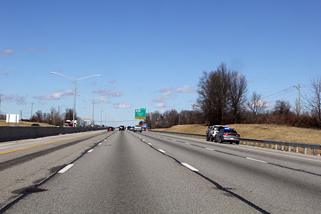
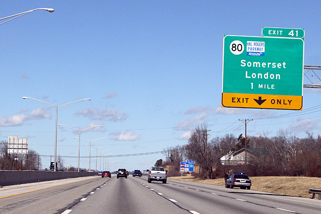
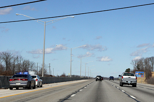
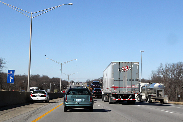
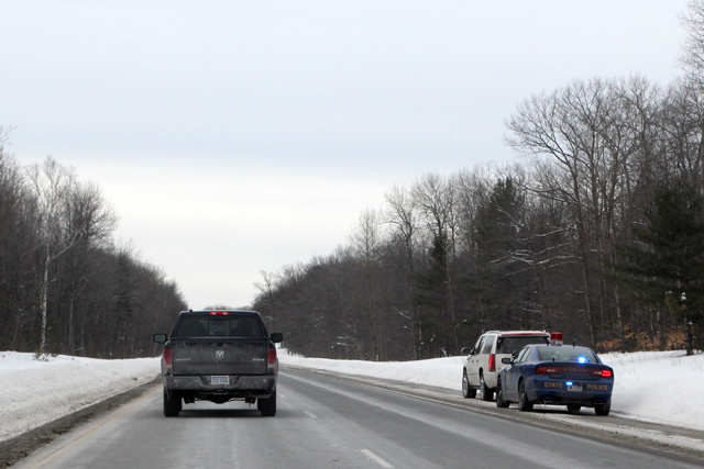
Police of I-75
Craziest Drivers
From the perspective of a Michigan driver, the Floridians were the worst. I’m sure they have the most triple-lane changers, going from the left-most lane, through the center, all the way to the right (or vice-versa). The aggressive drivers come up on slow drivers in the left lane, go around the drivers minding their own business in the center lane, and passes on the right. They handily beat Michigan in the hey-look-there’s-my-exit-I-better-exit-from-the-left-lane-right-now drivers.
I even saw a Floridarite driver do the extremely difficult double-quadruple lane change exit, going from the right lane, through two center lanes to the left lane to pass a couple of cars, and then immediately exit on the right. That amazing moved deserved both a gold medal and the electric chair.
They have no concept of the zipper merge here, or any other kind of merging. Half of the people drive slowly, half drive aggressively, and half are just trying to get to their destination without becoming collateral damage. It’s like the Detroit area, but expanded to the whole state.
- Florida
- Ohio
- Georgia
- Kentucky
- Michigan
- Tennessee
Most Sane Drivers
HA! That’s a trick category—all drivers are crazy.
Most Pleasant to Drive
I’ve taken a lot of factors into consideration for this category, like traffic density, road conditions, scenery and enthusiast fun-factor, and totally ignored them all.
- Tennessee
- Kentucky
- Michigan
- Georgia
- Florida
- Ohio
Driving Days Are Here Again
I didn’t return to my starting point of Sault Ste Marie. If I did, that would add another 325 miles. Also, I did not follow I-75 on the way back, which saved me time in Florida and helped getting around Atlanta during the morning rush hour.

The Video
[1] This is an arbitrarily Michiganian-centric designation of “end.”↩
[2] It is not known if George Mallory made it all the way to the peak of Mount Everest. He set off with Andrew Irvine in 1924, and their bodies were discovered in 1999. The pair was last seen about 800 vertical feet from the summit. It is not known if they made it to the top, and they obviously didn’t make the descent back down. Maybe I should have picked somebody else to quote.↩
Crankiness Rating: 0 out of 11 (Because Road Trip.)
![]()